Mykolaiv region under fire:
interactive map of enemy attacks
in the southern region of Ukraine
Since the beginning of the full-scale invasion, the Mykolaiv region has suffered from enemy shelling almost every day. The intensity of Russian attacks significantly decreased only after the deoccupation of Kherson. The latest data of the OVA indicate that more than 17,000 civilian objects were damaged: 11,799 residential premises, 105 medical institutions and 422 educational institutions.
Artillery, drones and missiles: what weapons did the occupiers use to attack Mykolaiv Oblast
The map of Russian strikes in the Mykolaiv region, developed by Nikcenter, is interactive. Move the map with the mouse wheel or your fingers on the phone screen to the settlement or area you are interested in. Each type of weapon is marked with a separate icon. Due to the large number of shellings, it is necessary to zoom in on the map to a specific location in order to see all the hits. On the left side of the map, you can choose a date range. Note: not all hit coordinates are accurate due to lack of information or for security reasons.
As of May 16, since the beginning of the Russian invasion, 17,837 civilian objects have been partially or completely damaged in the Mykolayiv region.
Residential premises
Medical institutions
Schools
Cultural institutions
As in other regions, in the Mykolaiv Oblast, Russian troops mercilessly attack civilian infrastructure. This leads to the death of civilians, including children. Since the beginning of the full-scale invasion in the region, 89 children have already suffered from the armed aggression of the occupiers.
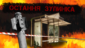
Civilians under fire
Move the map with the mouse wheel or your fingers on the phone screen to the settlement or area you are interested in. Yellow marks show places where civilians were injured, and red marks where people died. The size of the markers depends on the number of victims of a particular shelling. Click on the point to see a description of the effects of the shelling. On the left side of the map, you can choose a date range. Note: not all hit coordinates are accurate due to lack of information or for security reasons.
The Center for Journalistic Investigations analyzed which objects and with which weapons the Russians attacked in the Mykolaiv region. The result of the work was an interactive map on which the enemy shelling of the region from the beginning of the full-scale invasion and their consequences were recorded. The basis was official data published by Mykolaiv OVA, as well as photo and video materials in the media.
Strikes on civilian objects
Administrative buildings
Shops and other social facilities
Fields and forests
Critical infrastructure
Cultural complexes
Enterprises
Houses
Hospitals
Schools
The interactive map features markers that indicate destruction due to enemy attacks. Move the map with the mouse wheel or your fingers on the phone screen to the settlement or area you are interested in to see all the marked markers. Above the map there is a description of all the marks. Click on the icon on the map to read more about the consequences of the shelling. On the left side of the map, you can choose a date range. Note: not all hit coordinates are accurate due to lack of information or for security reasons.
Authors: Olesya Boreyko, Maria Ivannikova, Oleg Oganov, Oksana Orsach, Alyona Petruk, Oleksandr Sidelev